
The spread of digital technology in the Sudano-Sahel is transforming the way pastoral communities practice their livelihood in the context of growing environmental, social, and political instability. Although pastoralism is often viewed as a practice from a pre-modern era, it has always been adaptive, and pastoralists are now adapting to the digital age. The rapid spread of inexpensive mobile devices is enabling residents of rural areas the ability to communicate across distance and access valuable information. The penetration rate of mobile telecom (SIM) in Sub-Saharan Africa is expected to reach 86% by 2025. In eastern Africa, pastoralists have been early adopters of mobile phone applications and in western Africa they have been the principal users of SIM-based climate information services.
Increasing access to new technological platforms and tools has the potential to reduce risks of conflict by strengthening the services available for mobile populations – from access to natural resources to protection against livestock theft (see Module -Rural Development). Direct access to geospatial data can help local leaders and individuals make more informed decisions about how to harmonize pastoral migration routes and farmland. Innovations in remote tracking tools for livestock can help authorities respond more effectively to theft in insecure areas.
While new technologies hold the potential to support peacebuilding, they are not an automatic solution. Investors and practitioners must be mindful of the limits of any new technology including the cost and scalability. Most importantly, efforts to introduce new technologies must be accountable to the needs of the local pastoralist or farmer who will use them. The most effective tools are not always the ones that are the most technologically innovative, but the ones that are accessible and useful to the communities they are intended to help.
This Module outlines several different types of digital technology that each have the potential to support peacebuilding outcomes. Many of these technologies are still evolving but are likely to play a substantial role in the future of pastoralism in the Sudano-Sahel.


Historically, local communities have accommodated pastoral migrations through shared understanding of the routes where herds pass through and places where they need to graze. However, in recent decades, greater resource pressure and changes in the timing of livestock movements have increased the need for stricter demarcation of migration corridors at a national or regional scale. Efforts to map and mark migration routes are complex and cumbersome, which has increased the need for technological support. The introduction of handheld global positioning systems (GPS) technology – such as in phones – and digital maps allow local stakeholders to easily access comprehensive and up-to-date information. GPS and digital mapping technology can be used to identify the areas where seasonal resources are available and where there is a need for corridors to connect such areas across agro-pastoral landscapes.
These tools can be used to facilitate more inclusive and equitable resource governance. In Sudan, for example, scientists and practitioners are using geospatial data collected from GPS and satellite sources to pinpoint the reasons why livestock herds begin their seasonal movements through areas such as Kordofan, which is the location of many large-scale farming operations that may block livestock movements. Identifying resources or migration corridors in a map makes it easier to promote public awareness of land use agreements and protect against misuse (such as cattle traveling into unauthorized areas or farms expanding into migration corridors). However, access to geospatial data and even handheld GPS devices varies across the Sudano-Sahel. It is essential for interveners to be aware of the risk that the transition into the use of new technology can reinforce economic and regional inequalities.
Who should be responsible for maintaining digital maps? Keeping up-to-date maps often requires a level of infrastructure and technical expertise that may be out of reach for many local civil society leaders. In eastern Burkina Faso, the civil society network Le Réseau de Communication sur le Pastoralisme (RECOPA) developed a cartographic database of livestock corridors and grazing areas in 27 municipalities that can be accessed by local governments and members of their pastoralist network. RECOPA created this database with the help of their own geographic information system (GIS) experts and field agents and has sustained it at low cost by using an open-source platform and integrating with local livestock markets. The maps provide a necessary service to pastoralists, who rely on them to avoid cultivated areas during their seasonal migrations.
However, as a grassroots organization, RECOPA faces significant constraints in its use of technology. Hardware and software limitations prevent it from utilizing cloud-based data storage and deployment, which prevents rapid and efficient modifications to its maps. A lack of capacity building opportunities means that its agents do not necessarily gain exposure to best practices or technology innovations that could strengthen their practice.
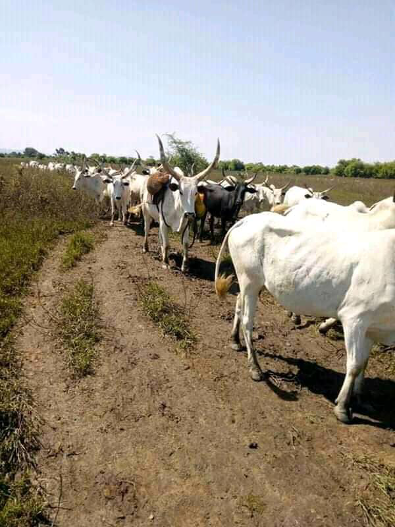
Image: Cattle traveling along migration routes in the Sahel. Credit: Shidiki Abubakar Ali
To survive in arid Sahelian climates, pastoralists must be able to adapt to changing conditions in their environment. Understanding where to access surface water and pasture year-round, particularly during drier periods, is essential to the survival of pastoral herds. Pastoralists have traditionally coped with this uncertainty through non-digital approaches, such as sending out scouts ahead of their herds. However, digital climate information services can provide pastoralists with more detailed data on resource availability or weather patterns through a combination of satellite images, georeferencing tools, and informants on the ground. This information can then be transmitted to the public via radio broadcasts, SMS, call-in centers, or applications for mobile devices. These services frequently expand beyond climate data to cover a range of other relevant information including livestock prices, locations of veterinary stations and vaccination parks, disease occurrences, concentrations of cattle, and areas of conflict. Advances in cloud computing and user interface facilitate a seamless link between data source and local users. As a result, pastoralists in remote areas can access information to help them plan their migration routes, find necessary resources and, at times, avoid confrontations with farmers, bandits, or other pastoralists.
Climate data also has potential applications to guide investments in stabilization, development, and responses to conflict. Advances in data analysis tools enable experts to anticipate risks for drought or resource shortages that are likely to displace pastoralist communities and spark local conflicts. With this information, development agencies and others can take pre-emptive action to assist pastoral and sedentary communities before they are devastated by natural disasters and before conflicts escalate.
The Pastoral Early Warning System (PEWS) – developed by Action Contre la Faim – is an information service that shares data with governments, humanitarian actors, and pastoralists via email, local radio, SMS, and online bulletins. Satellite images provide information on pasture (biomass) and surface water availability and accessibility, and paid local informants submit weekly surveys via SMS on topics including pasture, livestock concentration, water sources, cattle health, market prices, bush fires, and conflict. Both sets of data are analyzed by artificial intelligence and further validated by local actors and government ministries. This system illustrates how digital data collection and local, experiential knowledge can be complementary and mutually reinforcing. By providing this information through public channels, PEWS can be used by pastoralists to support all kinds of decisions for managing their livestock.

While pastoralists in the Sudano-Sahel consistently adapt to uncertain weather conditions, severe events like flooding or drought can force them to migrate to new areas and bring them into conflict with local host communities. Using advanced data mining algorithms, the crowdsourcing platform Omdena designed a system to predict conflict hotspots in Somalia based on climate and migration data. These data mining tools (including Support Vector Machine and Random Forest algorithms) allowed Omdena and to predict where flooding or drought events are likely to displace large groups of people and push them into regions where conflict risk is high because of insufficient resources for both the migrants and host population. That information was provided to the United Nations High Commission for Refugees (UNHCR) and other humanitarian partners to inform their decisions about how to allocate resources.
Image: Pastoralists from the Southern Nationalities, Nations, and People’s State in Ethiopia walk their cattle through flooded areas that they have been forced to leave after severe floods in 2006. Credit: Abraham Fisseha/AFP via Getty Images
Pastoral livestock and the herders who take them on migration are frequently targeted for theft by bandits and armed groups, fueling the proliferation of small arms (see Module – Law Enforcement and Counterterrorism). Livestock are an appealing target, in part, because they can be easily hidden in an isolated area such as a protected forest or quickly sold in a nearby market. Once they are stolen, they are difficult to find and recover. The rampant increase in livestock theft across the Sudano-Sahel has increased the need for innovative technological solutions to policing pastoral rangelands. In Senegal, for example, the mLouma network allows livestock keepers to rapidly communicate theft incidents using internet and cellular networks to law enforcement authorities with the goal of making it easier to track and recover livestock quickly. Unmanned aerial vehicles (UAV) have also been used to monitor isolated areas where thieves may attempt to hide stolen livestock before they can sell them.
The most commonly used technology for keeping track of livestock is radio frequency identification (RFID) tags. RFID devices allow animals to be remotely tracked (over a limited distance) and allow for greater transparency in buying and selling livestock. RFID devices hold an electronic record of the ownership of an animal, along with veterinary records and other information. This technology makes it easier to regulate livestock markets and enable merchants to accurately verify the owner of a cow before it is sold. Using RFID devices in conjunction with tamper-proof electronic record systems (e.g., blockchain) has the potential to transform livestock markets by replacing paper records of an animal’s health or origin with more secure digital records. These tools can make the livestock trade more transparent and easier to regulate, which will diminish the market value of stolen livestock and make the industry more attractive to investors. However, within the Sudano-Sahel, each of the technologies described in this section are in limited use, particularly in regions that are outside the effective control of law enforcement.

The Center for Information Technology and Development (CITAD), based in Kano, Nigeria, established a web-based system to provide officials and law enforcement agencies with real time alerts of cattle rustling. The Cattle Rustling Information System (CaTRIS), used social media based crowdsourcing and Ushahidi open-source software to collect information and communicate with users at minimal cost. The crowdsourcing platform enabled victims of theft to send out an alert to other users of the CaTRIS system along with information on the probable location of their stolen cattle and the markets where the livestock were likely to be taken. In order to make the system usable for illiterate populations, CITAD created a user interface based on symbols identified through focus group input. Despite the service’s relatively low cost (<$1 USD), the CaTRIS system had difficulties attracting users due, in part, to the fears of reprisals from corrupt authorities who are benefitting from livestock theft. Without revenues from user fees, maintaining the web infrastructure became financially untenable.
Image: A man takes a photo of his cattle in the Kachia Grazing Reserve in Kaduna State, Nigeria. Credit: Luis Tato/AFP via Getty Images.
Various livestock tagging and tracing systems have been attempted across the African continent, but often with limited success in scaling up into a universal practice. Livestock theft was a serious problem in Botswana until the country implemented a comprehensive livestock traceability system in 2000 to meet the sanitary standards of the European Union, the country’s main livestock market. The legal requirement that all cattle must be tagged and registered in the system’s database at birth has become a significant deterrent to theft. A key to the system’s success is sustained public sector support: the Botswana government has invested up to $100 million USD in the system since 2000 and it continues to subsidize the cost of tagging animals. The tracing system uses a variety of identification technologies including rumen boluses that cost up to $3-4 per individual tag.
Overall, traceability systems have had more limited success within the Sudano-Sahel. The Intergovernmental Authority on Development (IGAD) piloted a regional traceability scheme in eastern Africa, but it was limited to approximately 2000 head of cattle and did not scale up due to a lack of adoption by users and inadequate political support from authorities. In part, this system was limited by the insufficient cellular network coverage in many parts of the region. In Nigeria, private sector firms such as Livestock247 are attempting to replicate Botswana’s success, but have been hindered by the high costs and low level of demand. Nigeria’s unreliable electrical grid drives up the cost of using mobile technologies, and because livestock markets are mostly informal, the demand for costly traceability technologies is low because they currently do not translate into a higher price for livestock sellers.
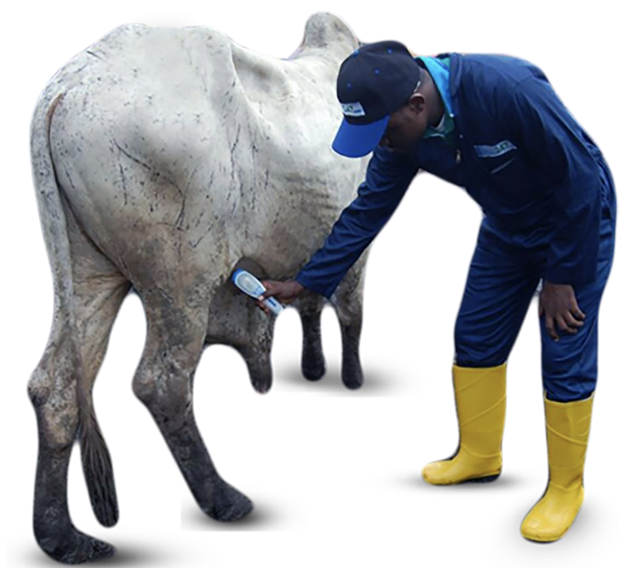
Image: Livestock247’s RFID digital livestock traceability tool used in Nigeria. Credit: Livestock247.com